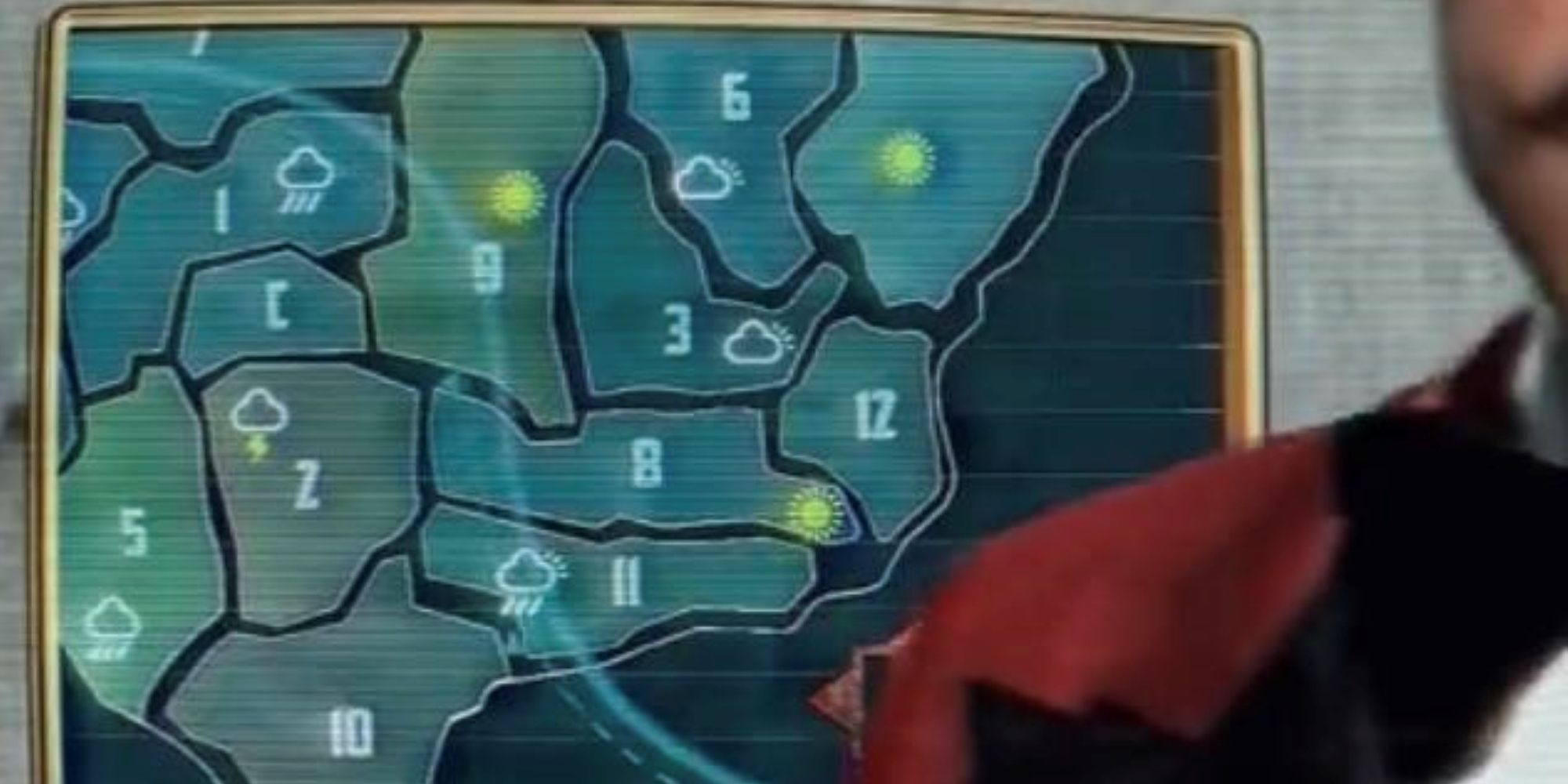
Where The Capitol & Districts Are Located
Summary
- The Hunger Games franchise, including the newly adapted “The Ballad of Songbirds & Snakes,” is set in the dystopian world of Panem, which was created from what used to be North America after a devastating war and ecological disasters.
- The map of Panem reveals the locations of the Capitol and the districts, with the Capitol situated where Wyoming and Colorado meet. Each district is known for providing different goods and services to the Capitol.
- The map of Panem is smaller than real-life America, likely due to some areas sinking into the oceans. The districts are spread out across various states, with District 12 (Katniss’s district) being mainly Virginia and District 13 covering the northeastern coast.
The Hunger Games franchise is one of the most well-known, successful dystopian series of all time, with Suzanne Collins’ worldbuilding helping it stand out. The franchise was recently expanded with the premiere of The Hunger Games: The Ballad of Songbirds & Snakes, a prequel book. The Hunger Games is set in Panem, where those fortunate enough to live in the Capitol enjoy not just the luxuries created in the 12 districts, but watching children fight each other to the death in the annual Hunger Games.
The Ballad of Songbirds & Snakes is set just a decade after the First Rebellion that left the Capitol devastated as they attempted to rebuild and reassert their control over the districts. Following the war, the Capitol created the Hunger Games, but it didn’t necessarily start out as entertainment. The setting of The Hunger Games is vital to the story, but there has been some confusion regarding the map of Panem.
The Hunger Games Map Is A Future Version Of North America
The Hunger Games is set roughly 300 years in the future, and Panem is what used to be known as North America. The 12 districts and the Capitol were created after modern civilization collapsed following an apocalyptic war and ecological disasters. The rest of the world isn’t explored in The Hunger Games, and little is known of what happened that led to Panem’s creation in the first place, but it can be assumed that it is the last living civilization of its time.
The Hunger Games never provided a clear map, leaving readers to rely on context clues to make their own. However, The Ballad of Songbirds & Snakes briefly features images of Panem’s map as shown by weatherman Lucretius “Lucky” Flickerman. The map reveals what was left of North America, as well as where the Capitol and districts are located.
How The Capitol & Districts’ Locations Compare To America’s Geography
At the heart of Panem, the Capitol is the smallest area, located along where Wyoming and Colorado meet. Each district in The Hunger Games is known for providing different materials and services crucial to the Capitol’s economy, with goods crossing borders rather than civilians. Right below the Capitol is District 2 (mainly Colorado and parts of New Mexico and Texas) with District 1 (Wyoming and Utah) above it. It is also bordered by District 9, one of the largest districts, as it encompasses both the Dakotas and Nebraska.
The map of Panem in The Hunger Games is much smaller than America’s, likely due to areas sinking into the surrounding oceans. District 10 favors Texas, suggesting that neighboring New Mexico and parts of Arizona became District 5. District 11 represents some of Louisiana, Mississippi, Alabama, and Georgia. North of it, District 8 appears to cover Tennessee, the Carolinas, and Missouri. District 12, where Katniss is from, is mainly Virginia, with District 13 above it accounting for the rest of the northeastern coast.
Districts 3 and 6 meet to cover much of the midwest, located to the left of the unnamed District 13. Rivaling District 9 in size are 4 and 7. District 7 is right above District 1, taking over most of the northwestern states, stretching across Montana and more. Lastly, District 4, which is on Panem’s western border, is where Nevada and potentially the parts of California that remain once were. The map of Panem in The Hunger Games has led to many fan theories and creations, and the map gives viewers even more to speculate about.
#Capitol #Districts #Located


